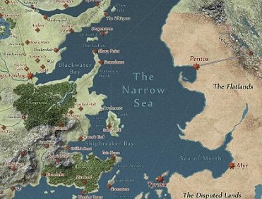
 The Game of Thrones series opens every televised episode with a fantastical, moving map, detailing the terrain and boundaries of the Seven Kingdoms. In the show, fans watch battles, treacherous river crossings, and rugged mountain travels. Truly invested fans can then refer to the maps to confirm their understanding.
It’s cool escapism. But I tend to think NickerNews and BestHorsePractices readers prefer the real landscape and real escapism of their own backwoods and familiar trail systems.
Since landing in the Oquirrh mountain foothills of Utah, I’ve learned my way around, shed my fear of steep ascents and descents, adapted to the 6,000 foot elevation, and embraced the rocky terrain (with the help of Renegade Hoof Boots).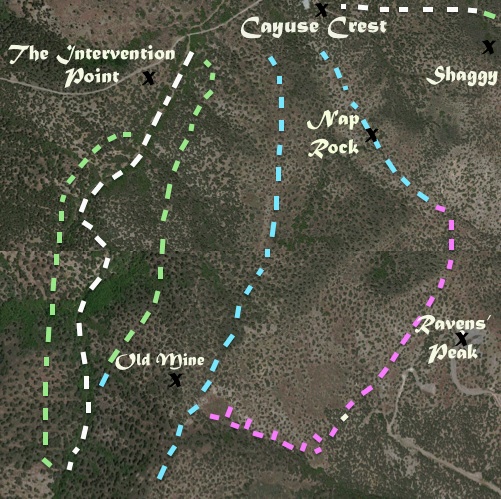
Thanks to satellite imagery and USGS topographic maps, I’ve detailed local features and trails and given them names to make it easier to chat about them with family, friends, and fellow riders. There is Nap Rock, Tent Ridge, Raven’s Peak, the Meeting Place, the Intervention site, and so on.
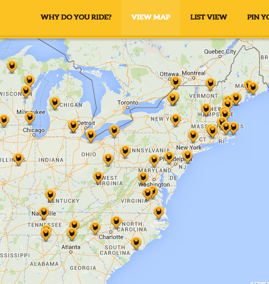
Redmond Equine is building a fun, interactive map of their own. It covers the entire globe and has hundreds of pins for Fave Rides. Anyone can add a pin by sending an image of their Fave Ride (photo must be taken with horse’s ears in the foreground!) and providing a location. Check out my Fave Ride here.
Add yours by visiting this page.
Check out this GoPro tour of the Oquirrh foothills.
Happy Trails!